Flinders St
The city, with the shortcuts left in.
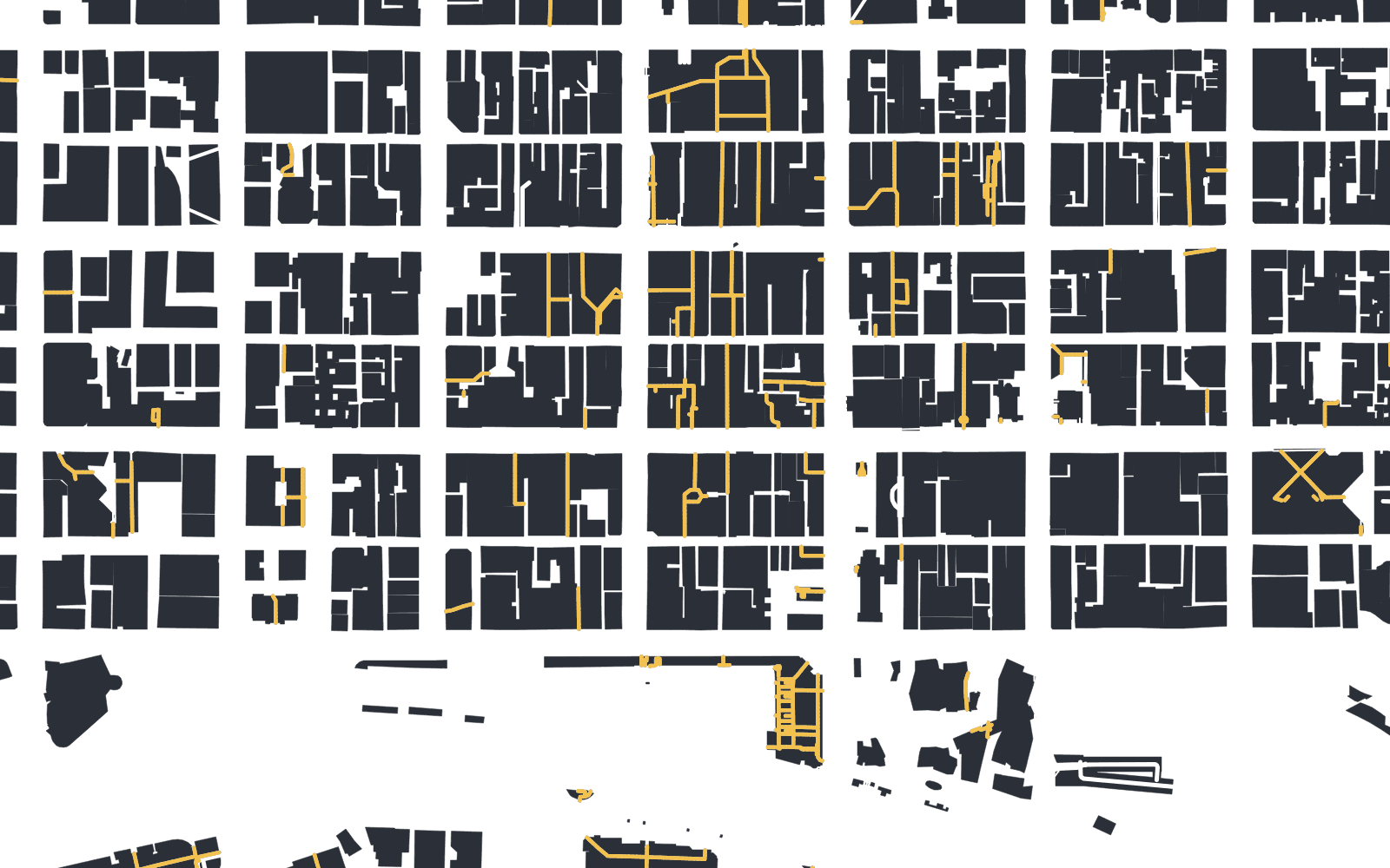
We’re building a walking map of Melbourne’s CBD that knows which arcades and lanes cut through the blocks, and when they’re open.
Degraves St
Ordinary maps send you round the block.
Tell A2B where you’re going and it will find the way through the blocks: arcades, lanes and building passages, checked against their hours for the minute you’ll reach each door.
Map apps either don’t know these passages go through, or don’t know when they lock, so they keep you on the streets. This walk turns off Flinders St into Degraves St and only meets traffic again to cross Collins St and Little Collins St.
Block Arcade
Through the arcades, most of the walk is under a roof.
A shortcut saves a minute or so on a 5 to 10 minute walk. The bigger difference is the roof. On three of our prototype’s four demo trips, the way through kept 65 to 84% of the walk under cover, against 0 to 29% by the streets.
Degraves St to Bourke St Mall
Through Centreway Arcade, Collins Arcade and Melbourne Walk. Saves 1.6 minutes.
Bourke St Mall to Melbourne Central
Through David Jones, the Emporium and Melbourne Central. Saves 1.6 minutes.
Block Arcade to Melbourne Central
Through Block Arcade, Royal Arcade, Myer, the Emporium and Melbourne Central. Saves 1 minute.
Flinders St Station to Royal Arcade
The quickest way saves only 0.6 minutes. Asking for the driest way adds 15 m and doubles the time under cover.
Each strip is a walk drawn to the same scale, starting on the left. Gold is under a roof. Worked out by our routing prototype from OpenStreetMap data for a Tuesday at 12:30 pm. It counts distance only, not waits at the lights, and none of it has been checked on foot yet.
Royal Arcade
The shortcut shuts at night.
On a Tuesday, all four passages on the classic walk from Degraves St to Bourke St Mall are open at noon. The arcades lock at about 6 pm, and by 11 pm the only one left is Centre Place, which is an open lane. So at 11 pm A2B will take you by the streets.
It will check each door for the time you’ll reach it, not the time you set off.
Centre PlaceOpen lane, all day
Centreway8 am to 6 pm, indicative
Block Arcade8 am to 6 pm, posted
Royal Arcade8 am to 6 pm, indicative
The hard part is finding the door.
GPS drifts between tall buildings and gives up under a roof, so the app shows you what to look for instead. These are design mockups for the pilot; the times and hours in them are examples.


Bourke St Mall
Walk it first, this summer.
The pilot is free and starts in the CBD. Leave your email and we’ll tell you when it’s ready to try.
Take the 2-minute survey
Four short steps on how you walk the CBD. Your answers decide what we build first and which streets we map first.
Take the surveySend us a shortcut
Tell us the way through you’d never give up, and we’ll go and check it on foot.
Email us a shortcutQuestions
- Can I download it?
- Not yet. We’re building a pilot for the CBD, starting this summer. Join the waitlist and we’ll email you when it’s ready to try.
- Is it free?
- The pilot is free. After that we haven’t decided: it might stay free or cost a small amount a year. The survey asks what you’d think is fair.
- How do you know the hours?
- Open map data lists 404 possible indoor links in the CBD, but hours for only a handful. So we check them on foot: the signs on the doors, plus visits early, at closing time and at night. Hours we haven’t confirmed are marked indicative, and when we’re unsure we send you by the streets.
- Is it OK to walk through these places?
- We only route through places that are open to the public, and only during their hours. They’re still private property, so keep moving, mind the shops and follow staff and signs. If a place asks people not to cut through, we’ll take it off the map.
- Which cities?
- Melbourne’s CBD first, between Flinders St and La Trobe St. Other cities only if it works here.
- iPhone or Android?
- Not decided yet. The survey asks which phone you use, and the answers decide which we build first.
- What happens to my email?
- We use it to tell you when the pilot opens and to invite you to test it. Only the two of us can see it, and it’s never sold or shared. Email hello@atwob.app and we’ll delete it. More in the privacy note.